
Above-Ground is an alternative London tube map that offers an additional information layer indicating the possible station connections by foot. All stations that are reachable within a 5 minutes walk are highlighted.
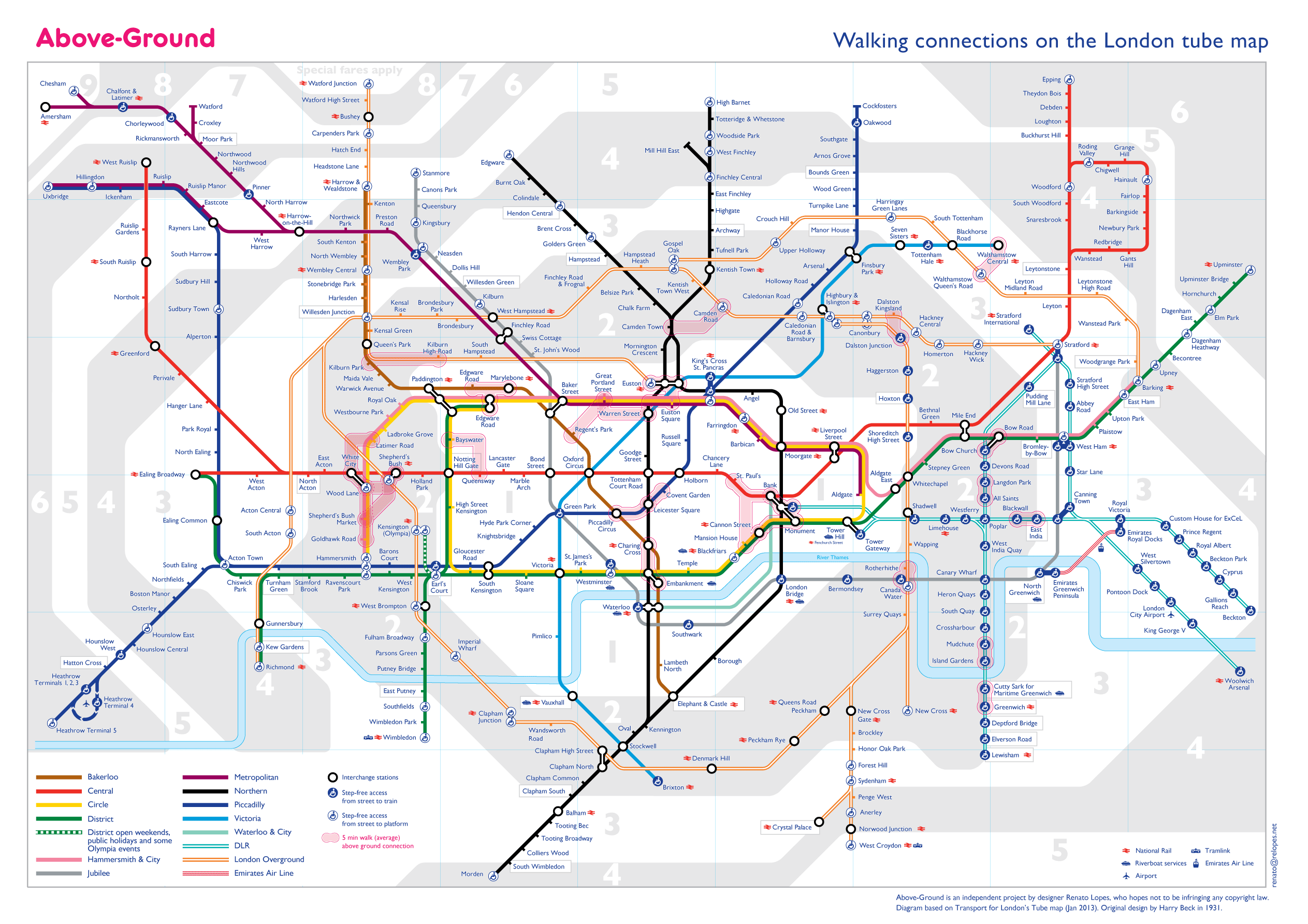
Going underground is in most cases the best way to get to and from different areas of London. However it is true as well that in some cases the distance between stations is so small that it could take you less then 5 minutes to connect between them on foot.
The problem is, from looking at London's Tube map it is not possible to tell when this is the case as the map is not true to scale.
The current design model for the Underground network map has been in place and evolving since 1931 when Harry Beck's circuit board-like proposal was first trialed. The basic premise of this model is that scale and distances are not relevant to tube users when underground.
However true, the flip side to this is that in a city with narrow and windy streets we sometimes don't know how far, or more importantly how close, places are. This often results in unnecessary commuting and we might miss the opportunity of a healthy and interesting walk above ground.
Above-Gound is an alternative map that explores exactly this lost connection with the actual distances and invites people to save time, walk and explore London's streets while avoiding crowded tube journeys and saving a few pounds.
The map is available in Gif and Pdf formats and is free to download. If you like it please share :-).
If you have suggestions, corrections or comments, please feel free to send me an e-mail.
![]()
